| You are here: Almanahj Website ⇒ American curriculum ⇒ 4th Grade ⇒ Geology ⇒ Term 1 | ||
|---|---|---|
The Earth Layers Maps and Globes Test | ||
|---|---|---|
| Subject: Geology | ||
| 4th Grade | ||
| Term 1 | ||
| Year: 2023/2024 | ||
| Size: 378.7KB | ||
| Number of clicks: 150 | ||
| Publish date:November 29, 2023 | ||
| Added by: Eman | ||
| Last download date: 2024-09-07 02:00:26 | By: theodor María Liste Romera | |
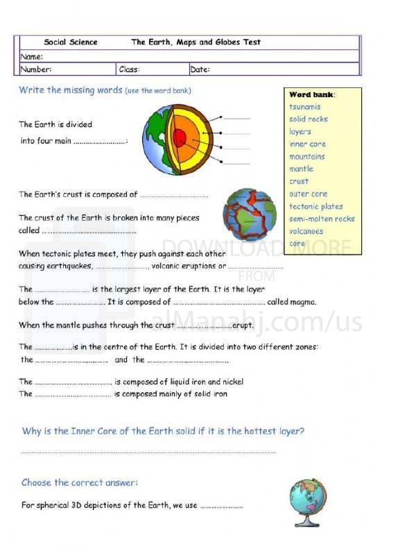
| File info: Maps and globes are commonly used to represent the Earth's layers and provide a visual depiction of its internal structure. While maps and globes primarily display the Earth's surface features, they can also include representations of the Earth's layers to convey information about its composition and structure. Here's how maps and globes can help visualize the Earth's layers: 1. Cross-Section Diagrams: Cross-section diagrams are often used to illustrate the Earth's interior layers. These diagrams show a vertical slice through the Earth, depicting the different layers such as the crust, mantle, outer core, and inner core. They provide a simplified representation of the Earth's structure and can be included on maps or in educational materials. 2. Topographic Maps: Topographic maps show the Earth's surface features, including mountains, valleys, and bodies of water. While these maps do not directly depict the Earth's layers, they can indirectly provide information about the surface expression of geological processes and the distribution of different rock types. This information can be correlated with the Earth's layers. 3. Satellite Imagery: Satellite imagery, often used in mapping applications, provides detailed visual representations of the Earth's surface. While it does not directly show the Earth's layers, it can help identify geological features that are associated with specific layers. For example, volcanic mountains and mid-ocean ridges can indicate areas where the Earth's crust interacts with the underlying mantle. 4. Globes: Globes are three-dimensional representations of the Earth. While they primarily show the Earth's surface features, they can also include cross-sectional features or layers to provide a more comprehensive understanding of the Earth's structure. Some globes include removable sections that reveal a simplified representation of the Earth's layers, allowing for a visual exploration of its interior structure. It's important to note that representing the Earth's layers accurately on maps and globes can be challenging due to the vast scale and complexity of the Earth's interior. The Earth's layers are not easily visible or accessible, and our understanding of them comes primarily from indirect methods such as seismic studies and laboratory experiments. Nonetheless, maps, globes, and other visual representations play a valuable role in helping us conceptualize and communicate the Earth's internal structure. | ||
| Downloading link The Earth Layers Maps and Globes Test |
|---|
|
1701255283.pdf
The file is being prepared for download
|
| File images |
|---|
 |