| You are here: Almanahj Website ⇒ American curriculum ⇒ 7th Grade ⇒ Geology ⇒ Term 1 | ||
|---|---|---|
Worksheet about Topographic and Geologic Maps | ||
|---|---|---|
| Subject: Geology | ||
| 7th Grade | ||
| Term 1 | ||
| Year: 2023/2024 | ||
| Size: 224.2KB | ||
| Number of clicks: 94 | ||
| Publish date:November 21, 2023 | ||
| Added by: Eman | ||
| Last download date: 2024-08-29 23:18:09 | ||
| Updated by: Eman9966 on 2023-11-21 17:16:57 | By: theodor Grace Vogt | |
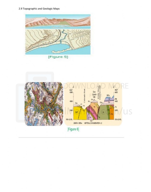
| File info: Topographic and geologic maps are two types of maps that provide different information about the Earth's surface. Topographic Maps Topographic maps show the elevation of the Earth's surface using contour lines. Contour lines connect points of equal elevation, and the closer the contour lines are together, the steeper the slope of the land. Topographic maps also show the location of features such as rivers, lakes, mountains, and valleys. Topographic maps are used for a variety of purposes, including: Planning hiking and backpacking trips Determining the location of property boundaries Assessing the potential for flooding or landslides Planning the construction of roads and buildings Geologic Maps Geologic maps show the distribution of different rock types on the Earth's surface. Geologic maps are created by geologists who study the rocks in the field and in the lab. Geologists use a variety of techniques to identify and map different rock types, including: Looking at the texture, color, and composition of the rocks Examining the rocks under a microscope Using chemical tests to identify the minerals in the rocks Geologic maps are used for a variety of purposes, including: Understanding the history of the Earth Locating mineral deposits Assessing the potential for geologic hazards such as earthquakes and volcanic eruptions Planning the construction of roads, tunnels, and other infrastructure projects Differences Between Topographic and Geologic Maps Topographic maps and geologic maps are both valuable tools for understanding the Earth's surface. However, there are some key differences between the two types of maps: Topographic maps focus on the elevation of the Earth's surface, while geologic maps focus on the distribution of different rock types. Topographic maps are created using surveying techniques, while geologic maps are created by geologists who study the rocks in the field and in the lab. Topographic maps are used for a wider variety of purposes than geologic maps. Conclusion Topographic and geologic maps are two important tools for understanding the Earth's surface. Topographic maps show the elevation of the land, while geologic maps show the distribution of different rock types. Both types of maps are used for a variety of purposes, including planning, resource exploration, and hazard assessment. | ||
| Downloading link Worksheet about Topographic and Geologic Maps |
|---|
|
1700578141.pdf
The file is being prepared for download
|
| File images |
|---|
 |